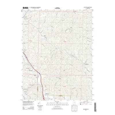
2013 Map of Macksburg
USGS Topo · Published 2013About this map
Macksburg and Dexter City anchor this portion of the Noble and Washington County border, where the rugged Appalachian Plateau terrain is deeply dissected by the West Fork Duck Creek and its many tributaries. The settlement pattern follows these winding valley floors and prominent ridge lines, such as Harrons Ridge and Heddleson Rdg, revealing a landscape shaped by rural communities and small-town industry. A high density of family and community burial grounds, including Atkinson Cem, Fulda Cem, and Harris Cem, provides significant data for genealogists tracing early families in the region.
Find a feature on this map
133 named features on this map. Tap any name to fly to it.
Don’t see what you’re looking for? This feature index may not catch every label — zoom into the map to look around manually.
Map Details
Editions of this 2013 Macksburg Map
This is the sole edition of this map. No revisions or reprints were ever made.
Other maps of this area

1903 · Macksburg
USGS Topo · 1:62,500

1905 · Macksburg
USGS Topo · 1:62,500

1909 · Caldwell
USGS Topo · 1:62,500

1909 · Summerfield
USGS Topo · 1:62,500

1911 · Cumberland
USGS Topo · 1:62,500

1911 · Summerfield
USGS Topo · 1:62,500

1912 · Caldwell
USGS Topo · 1:62,500

1949 · Clarksburg
USGS Topo · 1:250,000

1956 · Clarksburg
USGS Topo · 1:250,000

1961 · Clarksburg
USGS Topo · 1:250,000