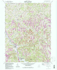
1994 Map of Macksburg
USGS Topo · Published 1998About this map
Macksburg and Dexter City anchor the southern reaches of this landscape where the Noble Co Washington Co boundary line meets the winding waters of West Fork Duck Creek. The terrain is characterized by a dense network of narrow valleys and ridges, with small settlements like South Olive, Moundsville, and Middleburg tucked into the drainage basins of Buffalo Run and Otterslide Run. Genealogists will find a wealth of family history sites, including the Harris Cem, McGinnis Cem, and several Macksburg Cems.
Find a feature on this map
39 named features on this map. Tap any name to fly to it.
Don’t see what you’re looking for? This feature index may not catch every label — zoom into the map to look around manually.
Map Details
Editions of this 1994 Macksburg Map
This is the sole edition of this map. No revisions or reprints were ever made.
Other maps of this area

1903 · Macksburg
USGS Topo · 1:62,500

1905 · Macksburg
USGS Topo · 1:62,500

1909 · Caldwell
USGS Topo · 1:62,500

1909 · Summerfield
USGS Topo · 1:62,500

1911 · Cumberland
USGS Topo · 1:62,500

1911 · Summerfield
USGS Topo · 1:62,500

1912 · Caldwell
USGS Topo · 1:62,500

1949 · Clarksburg
USGS Topo · 1:250,000

1956 · Clarksburg
USGS Topo · 1:250,000

1961 · Clarksburg
USGS Topo · 1:250,000