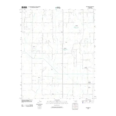
2009 Map of Macomb
USGS Topo · Published 2009About this map
The Little River meanders through this section of Pottawatomie County, defining a landscape shaped by both hydrology and hydrocarbon extraction. To the south, the settlement of Macomb sits at the intersection of Macomb Rd and state highway infrastructure, surrounded by active energy production sites including the South Macomb Oil Field. The map reveals a dense network of sectional roads and rural routes such as Patterson Rd and Stevens Rd, which provide access to family-led interests and local landmarks.
Find a feature on this map
56 named features on this map. Tap any name to fly to it.
Don’t see what you’re looking for? This feature index may not catch every label — zoom into the map to look around manually.
Map Details
Editions of this 2009 Macomb Map
This is the sole edition of this map. No revisions or reprints were ever made.
Other maps of this area

1896 · Seminole and Prague
USGS Topo · 1:125,000

1898 · Purcell
USGS Topo · 1:125,000

1907 · Maud
USGS Topo · 1:62,500

1908 · Maud
USGS Topo · 1:62,500

1909 · Shawnee
USGS Topo · 1:62,500

1910 · McComb
USGS Topo · 1:62,500

1930 · McLoud
USGS Topo · 1:62,500

1954 · Oklahoma City
USGS Topo · 1:250,000
1956 · Stella
USGS Topo · 1:24,000

1957 · Oklahoma City
USGS Topo · 1:250,000