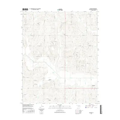
2016 Map of Macomb
USGS Topo · Published 2016About this map
The Little River meanders through this portion of Pottawatomie County, defining a landscape of creek-fed valleys and small rural communities. The map captures the quiet character of the Oklahoma countryside, anchored by the town of Macomb and the settlement of Pink. Local history is preserved in several burial sites scattered across the township, including Highland Cem near the center of the quadrangle and Prospect Cem to the south.
Find a feature on this map
85 named features on this map. Tap any name to fly to it.
Don’t see what you’re looking for? This feature index may not catch every label — zoom into the map to look around manually.
Map Details
Editions of this 2016 Macomb Map
This is the sole edition of this map. No revisions or reprints were ever made.
Other maps of this area

1896 · Seminole and Prague
USGS Topo · 1:125,000

1898 · Purcell
USGS Topo · 1:125,000

1907 · Maud
USGS Topo · 1:62,500

1908 · Maud
USGS Topo · 1:62,500

1909 · Shawnee
USGS Topo · 1:62,500

1910 · McComb
USGS Topo · 1:62,500

1930 · McLoud
USGS Topo · 1:62,500

1954 · Oklahoma City
USGS Topo · 1:250,000
1956 · Stella
USGS Topo · 1:24,000

1957 · Oklahoma City
USGS Topo · 1:250,000