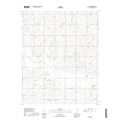
2018 Map of Macomb
USGS Topo · Published 2018About this map
Macomb and the surrounding rural townships of Pottawatomie County are defined by a network of creeks and sectional roads in this 21st-century landscape. The area south of the Little River is dotted with small, long-standing settlements such as Tribbey and Burnett, which maintain their identity amidst the rolling terrain of Turkey Hill. The mapping reveals a shift from early agricultural centers to a more dispersed residential pattern, connected by historic routes like Macomb Rd and Rattlesnake Hill Rd.
Find a feature on this map
48 named features on this map. Tap any name to fly to it.
Don’t see what you’re looking for? This feature index may not catch every label — zoom into the map to look around manually.
Map Details
Editions of this 2018 Macomb Map
This is the sole edition of this map. No revisions or reprints were ever made.
Other maps of this area

1896 · Seminole and Prague
USGS Topo · 1:125,000

1898 · Purcell
USGS Topo · 1:125,000

1907 · Maud
USGS Topo · 1:62,500

1908 · Maud
USGS Topo · 1:62,500

1909 · Shawnee
USGS Topo · 1:62,500

1910 · McComb
USGS Topo · 1:62,500

1930 · McLoud
USGS Topo · 1:62,500

1954 · Oklahoma City
USGS Topo · 1:250,000
1956 · Stella
USGS Topo · 1:24,000

1957 · Oklahoma City
USGS Topo · 1:250,000