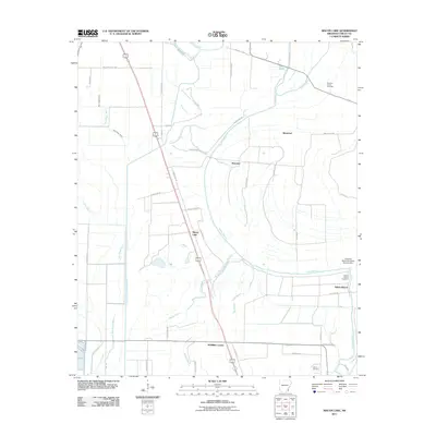
2011 Map of Macon Lake
USGS Topo · Published 2011About this map
Bayou Macon and its winding tributaries dominate this Chicot County landscape, revealing a complex drainage network vital to the region's delta agriculture. Small rural clusters like Macon Lake, Elmwood, and McMillan Corner are positioned along the primary transit corridors, while the Connerly Bayou Pumping Station Dam in the southeast highlights the engineering required to manage the area's hydrology. For genealogists and local historians, several family and community landmarks are visible, including the Pleasant Green Cemetery and Tolliver Cemetery. The map also illustrates the transition from natural watercourses like Swift Bayou and Crooked Bayou to man-made features such as Diversion Canal Number 1, reflecting decades of water management in the Arkansas lowlands.
Find a feature on this map
49 named features on this map. Tap any name to fly to it.
Don’t see what you’re looking for? This feature index may not catch every label — zoom into the map to look around manually.
Map Details
Editions of this 2011 Macon Lake Map
This is the sole edition of this map. No revisions or reprints were ever made.
Other maps of this area

1933 · Lamont
USGS Topo · 1:62,500

1936 · McGehee
USGS Topo · 1:62,500

1936 · Lake Village
USGS Topo · 1:62,500

1937 · McGehee
USGS Topo · 1:62,500

1939 · Refuge
USGS Topo · 1:62,500

1939 · Lamont
USGS Topo · 1:62,500

1953 · Greenwood
USGS Topo · 1:250,000

1955 · Lake Village
USGS Topo · 1:62,500

1955 · McGehee
USGS Topo · 1:62,500

1956 · Greenwood
USGS Topo · 1:250,000