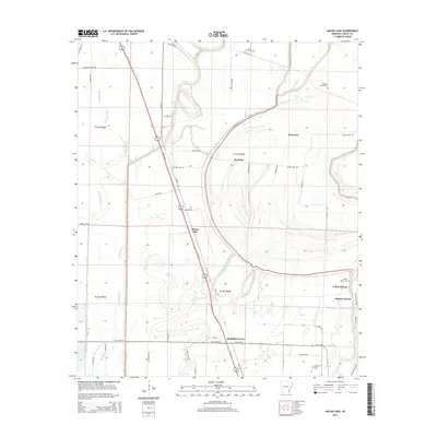
2014 Map of Macon Lake
USGS Topo · Published 2014About this map
Bayou Macon and its winding tributaries, including Swift Bayou and Boggy Bayou, define the drainage and agricultural patterns of this Chicot County landscape. The settlement at Macon Lake sits at a crossroads along Us 65 HWY N, which serves as a primary north-south artery through the region. This area is characterized by a high concentration of cemeteries, such as Yellow Bayou Cem, Holly Grove Cem, and Tolliver Cem, providing vital geographic anchors for genealogical research. Smaller hamlets like Elmwood, Bowman, and Panther Forest are dispersed among the bayous and drainage canals, illustrating the rural community structure of southeastern Arkansas. The map also traces managed water systems like Diversion Canal Number 1, highlighting the engineering required to maintain the low-lying terrain.
Find a feature on this map
61 named features on this map. Tap any name to fly to it.
Don’t see what you’re looking for? This feature index may not catch every label — zoom into the map to look around manually.
Map Details
Editions of this 2014 Macon Lake Map
This is the sole edition of this map. No revisions or reprints were ever made.
Other maps of this area

1933 · Lamont
USGS Topo · 1:62,500

1936 · McGehee
USGS Topo · 1:62,500

1936 · Lake Village
USGS Topo · 1:62,500

1937 · McGehee
USGS Topo · 1:62,500

1939 · Refuge
USGS Topo · 1:62,500

1939 · Lamont
USGS Topo · 1:62,500

1953 · Greenwood
USGS Topo · 1:250,000

1955 · Lake Village
USGS Topo · 1:62,500

1955 · McGehee
USGS Topo · 1:62,500

1956 · Greenwood
USGS Topo · 1:250,000