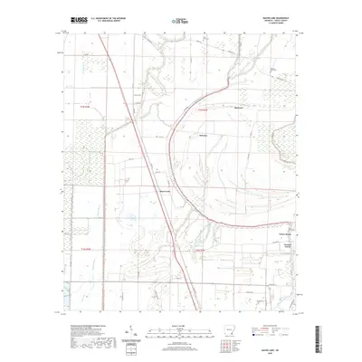
2020 Map of Macon Lake
USGS Topo · Published 2020About this map
Bayou Macon snakes through this Chicot County landscape, defining the low-lying wetlands and alluvial plains characteristic of the Arkansas Delta. The map reveals a high concentration of watercourses including Boggy Bayou, Swift Bayou, and Clay Bayou, which weave around small agrarian settlements. These communities, such as Elmwood, Bowman, and Panther Forest, are connected by a network of county roads like Chicot 53 Rd and Lewis Rd. For genealogists, the presence of several established burial sites, including Holly Grove Cem, Pleasant Green Cem, and Yellow Bayou Cem, provides specific points of interest for local family research. The landscape is marked by the distinct curvature of ancient river paths, evidenced by the oxbow-like shapes near Macon Lake and the isolated waters of Lost Lake.
Find a feature on this map
50 named features on this map. Tap any name to fly to it.
Don’t see what you’re looking for? This feature index may not catch every label — zoom into the map to look around manually.
Map Details
Editions of this 2020 Macon Lake Map
This is the sole edition of this map. No revisions or reprints were ever made.
Other maps of this area

1933 · Lamont
USGS Topo · 1:62,500

1936 · McGehee
USGS Topo · 1:62,500

1936 · Lake Village
USGS Topo · 1:62,500

1937 · McGehee
USGS Topo · 1:62,500

1939 · Refuge
USGS Topo · 1:62,500

1939 · Lamont
USGS Topo · 1:62,500

1953 · Greenwood
USGS Topo · 1:250,000

1955 · Lake Village
USGS Topo · 1:62,500

1955 · McGehee
USGS Topo · 1:62,500

1956 · Greenwood
USGS Topo · 1:250,000