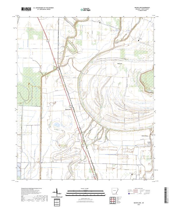
2024 Map of Macon Lake
USGS Topo · Published 2024About this map
Bayou Macon snakes through this low-lying landscape in Chicot County, defining a complex network of waterways that includes West Boggy Bayou, Clay Bayou, and Swift Bayou. The modern settlement of Macon Lake sits at the junction of US Hwy 65 278 and Co Rd 350, while the community of Panther Forest occupies the eastern edge near Connerly Bayou. The map reveals a land heavily managed for agriculture and conservation, evidenced by the extensive Farm Service Agency Interest of Arkansas tracts. For genealogists and local historians, the sheet preserves the locations of several burial grounds, including Pleasant Green Cem, Holly Grove Cem, and Yellow Bayou Cem. The presence of the Diversion Canal Number 1 and numerous drainage features highlights the ongoing engineering efforts to manage the alluvial terrain of the Arkansas Delta.
Find a feature on this map
53 named features on this map. Tap any name to fly to it.
Don’t see what you’re looking for? This feature index may not catch every label — zoom into the map to look around manually.
Map Details
Editions of this 2024 Macon Lake Map
This is the sole edition of this map. No revisions or reprints were ever made.
Other maps of this area

1933 · Lamont
USGS Topo · 1:62,500

1936 · McGehee
USGS Topo · 1:62,500

1936 · Lake Village
USGS Topo · 1:62,500

1937 · McGehee
USGS Topo · 1:62,500

1939 · Refuge
USGS Topo · 1:62,500

1939 · Lamont
USGS Topo · 1:62,500

1953 · Greenwood
USGS Topo · 1:250,000

1955 · Lake Village
USGS Topo · 1:62,500

1955 · McGehee
USGS Topo · 1:62,500

1956 · Greenwood
USGS Topo · 1:250,000