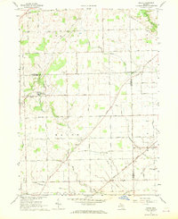
1967 Map of Macon
USGS Topo · Published 1969About this map
Agricultural lands at the border of Washtenaw, Lenawee, and Monroe counties define this landscape, where the Saline River cuts across the northeast corner and Macon Creek winds through the central plains. The settlement of Macon serves as a local hub, situated near the Boysville of Michigan campus. The mapping reveals a dense network of family-named roads like Pennington Road, Welch Road, and Goodrich Road, which connect numerous rural burial grounds including Benton Cem and Oakhill Cem.
Find a feature on this map
58 named features on this map. Tap any name to fly to it.
Don’t see what you’re looking for? This feature index may not catch every label — zoom into the map to look around manually.
Map Details
Editions of this 1967 Macon Map
2 editions found
Other maps of this area

1902 · Ypsilanti
USGS Topo · 1:62,500

1904 · Ann Arbor
USGS Topo · 1:125,000

1906 · Ypsilanti
USGS Topo · 1:62,500

1906 · Saline
USGS Topo · 1:62,500

1908 · Ann Arbor
USGS Topo · 1:125,000

1912 · Dundee
USGS Topo · 1:62,500

1926 · Dundee
USGS Topo · 1:62,500

1939 · Blissfield
USGS Topo · 1:62,500
1939 · Dundee
USGS Topo · 1:62,500
1940 · Dundee
USGS Topo · 1:62,500