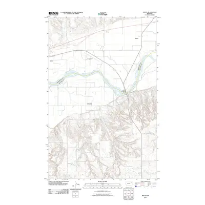
2011 Map of Macon
USGS Topo · Published 2011About this map
The Missouri River carves a winding path through this Roosevelt County landscape, serving as the central geographic feature of the region. Near the river's edge, the Lewis and Clark Bridge provides a vital crossing point, connecting the northern and southern road networks. North of the river, the small settlement of Macon sits alongside the rail corridor, while the Courchene Cemetery and Lyman Clayton Airport suggest a community shaped by local land ownership and essential services.
Find a feature on this map
23 named features on this map. Tap any name to fly to it.
Don’t see what you’re looking for? This feature index may not catch every label — zoom into the map to look around manually.
Map Details
Editions of this 2011 Macon Map
This is the sole edition of this map. No revisions or reprints were ever made.
Other maps of this area

1912 · Chelsea
USGS Topo · 1:62,500

1916 · Wolf Point
USGS Topo · 1:62,500

1954 · Glendive
USGS Topo · 1:250,000

1954 · Wolf Point
USGS Topo · 1:250,000

1957 · Glendive
USGS Topo · 1:250,000

1958 · Wolf Point
USGS Topo · 1:250,000

1958 · Glendive
USGS Topo · 1:250,000

1972 · Chelsea SW
USGS Topo · 1:24,000

1972 · Wolf Point
USGS Topo · 1:24,000

1972 · Macon
USGS Topo · 1:24,000