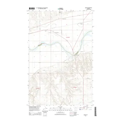
2014 Map of Macon
USGS Topo · Published 2014About this map
The Missouri River carves a deep path through this landscape on the border of Roosevelt and McCone counties. At the northern edge of the river valley, the small settlement of Macon sits along the rail line, while the Lewis and Clark Bridge provides a vital crossing point to the south. The terrain is defined by dramatic elevation changes where the high plains break toward the river, dissected by drainage features such as Brown Coulee and Little Wolf Cr.
Find a feature on this map
26 named features on this map. Tap any name to fly to it.
Don’t see what you’re looking for? This feature index may not catch every label — zoom into the map to look around manually.
Map Details
Editions of this 2014 Macon Map
This is the sole edition of this map. No revisions or reprints were ever made.
Other maps of this area

1912 · Chelsea
USGS Topo · 1:62,500

1916 · Wolf Point
USGS Topo · 1:62,500

1954 · Glendive
USGS Topo · 1:250,000

1954 · Wolf Point
USGS Topo · 1:250,000

1957 · Glendive
USGS Topo · 1:250,000

1958 · Wolf Point
USGS Topo · 1:250,000

1958 · Glendive
USGS Topo · 1:250,000

1972 · Chelsea SW
USGS Topo · 1:24,000

1972 · Wolf Point
USGS Topo · 1:24,000

1972 · Macon
USGS Topo · 1:24,000