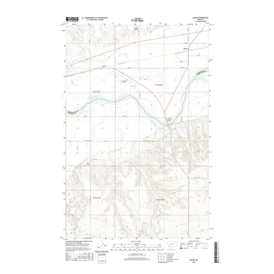
2017 Map of Macon
USGS Topo · Published 2017About this map
The Missouri River serves as the primary geographic and political divider in this 2017 survey, separating the southern hills from the northern plains and defining the boundary between Roosevelt and McCone Counties. The northern half of the sheet is characterized by more frequent human development, including the settlement of Macon and the small locality of Courchene. Transportation and infrastructure are clustered here, with Bia Rte 1 and numerous Bureau of Indian Affairs routes crossing the landscape near the Courchene Cem. Aviation is represented by both the L M Clayton Airport and the smaller Vine Airport located further south.
Find a feature on this map
35 named features on this map. Tap any name to fly to it.
Don’t see what you’re looking for? This feature index may not catch every label — zoom into the map to look around manually.
Map Details
Editions of this 2017 Macon Map
This is the sole edition of this map. No revisions or reprints were ever made.
Other maps of this area

1912 · Chelsea
USGS Topo · 1:62,500

1916 · Wolf Point
USGS Topo · 1:62,500

1954 · Glendive
USGS Topo · 1:250,000

1954 · Wolf Point
USGS Topo · 1:250,000

1957 · Glendive
USGS Topo · 1:250,000

1958 · Wolf Point
USGS Topo · 1:250,000

1958 · Glendive
USGS Topo · 1:250,000

1972 · Chelsea SW
USGS Topo · 1:24,000

1972 · Wolf Point
USGS Topo · 1:24,000

1972 · Macon
USGS Topo · 1:24,000