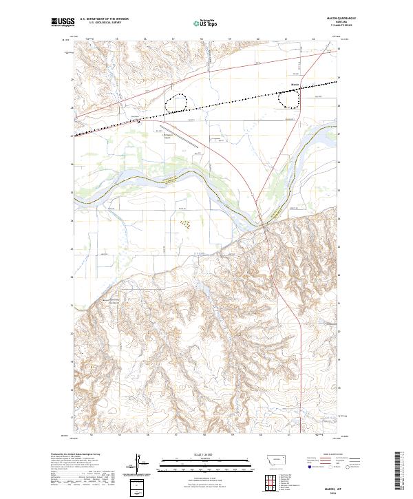
2024 Map of Macon
USGS Topo · Published 2024About this map
The Missouri River carves a deep, winding path through this northern Montana landscape, marking the boundary between Roosevelt and McCone counties. Along its northern banks, the settlement of Macon sits near the junction of several rural routes including RD 1068 and RD 2061. The area's aviation history is represented by the L M Clayton Airport and Vine Airport, reflecting the necessity of air travel in these wide-open plains. Local genealogy is anchored by the Courchene Cemetery, located south of the drainage from Little Wolf Creek. The terrain is defined by a network of drainage systems like Brown Coulee, U P Creek, and Nickwall Creek, which cut through the higher ground to meet the main river channel. This survey demonstrates the persistence of traditional land divisions, with section lines and grazing lands remaining the primary organizational features of the region.
Find a feature on this map
30 named features on this map. Tap any name to fly to it.
Don’t see what you’re looking for? This feature index may not catch every label — zoom into the map to look around manually.
Map Details
Editions of this 2024 Macon Map
This is the sole edition of this map. No revisions or reprints were ever made.
Other maps of this area

1912 · Chelsea
USGS Topo · 1:62,500

1916 · Wolf Point
USGS Topo · 1:62,500

1954 · Glendive
USGS Topo · 1:250,000

1954 · Wolf Point
USGS Topo · 1:250,000

1957 · Glendive
USGS Topo · 1:250,000

1958 · Wolf Point
USGS Topo · 1:250,000

1958 · Glendive
USGS Topo · 1:250,000

1972 · Chelsea SW
USGS Topo · 1:24,000

1972 · Wolf Point
USGS Topo · 1:24,000

1972 · Macon
USGS Topo · 1:24,000