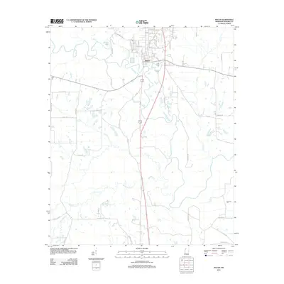
2012 Map of Macon
USGS Topo · Published 2012About this map
The Noxubee River meanders through this portion of Noxubee County, defining the western and southern reaches of Macon. As the county seat, the town's grid is established north of the river, with residential and commercial streets such as W Pearl St and Walnut St extending toward Howard Lake. The landscape is primarily shaped by its watercourses, including Horse Hunters Cr and Macedonia Cr, which cut through the surrounding agricultural and rural lands. To the south, the small settlement of Southlane sits along the primary highway corridor.
Find a feature on this map
56 named features on this map. Tap any name to fly to it.
Don’t see what you’re looking for? This feature index may not catch every label — zoom into the map to look around manually.
Map Details
Editions of this 2012 Macon Map
This is the sole edition of this map. No revisions or reprints were ever made.
Other maps of this area

1953 · Meridian
USGS Topo · 1:250,000

1953 · West Point
USGS Topo · 1:250,000

1957 · Meridian
USGS Topo · 1:250,000

1958 · West Point
USGS Topo · 1:250,000

1962 · Shuqualak
USGS Topo · 1:24,000

1963 · West Point
USGS Topo · 1:250,000

1963 · Gholson
USGS Topo · 1:24,000

1965 · Meridian
USGS Topo · 1:250,000

1973 · Cliftonville
USGS Topo · 1:24,000

1973 · McLeod
USGS Topo · 1:24,000