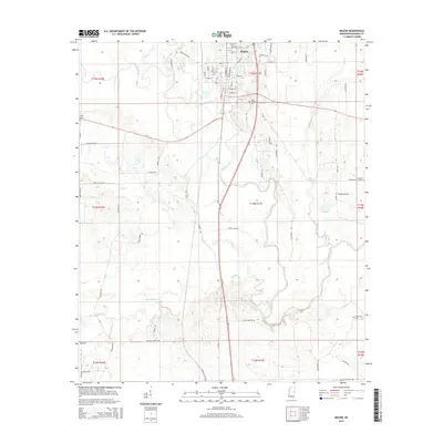
2015 Map of Macon
USGS Topo · Published 2015About this map
Macon serves as the focal point of this 2015 study, situated where the Noxubee River winds through the East Mississippi landscape. The town's grid is well-defined by historical corridors like Main ST, Jefferson ST, and Washington ST, revealing a concentrated settlement pattern characteristic of Noxubee County's seat. Beyond the urban center, the terrain is shaped by a dense network of tributaries including Hunters Cr, Plum Cr, and the appropriately named Running Water Cr. Genealogists and local historians will find significant value in the distribution of regional burial sites, such as the Odd Fellows Cem near the riverbanks and the more remote DeJarnate Cem and Zion Hill Cem. The land is further divided by numerous rural roads, such as Pineywoods RD and Allen Bend RD, which provide access to the outlying agricultural and wooded tracts surrounding Howard Lake.
Find a feature on this map
80 named features on this map. Tap any name to fly to it.
Don’t see what you’re looking for? This feature index may not catch every label — zoom into the map to look around manually.
Map Details
Editions of this 2015 Macon Map
This is the sole edition of this map. No revisions or reprints were ever made.
Other maps of this area

1953 · Meridian
USGS Topo · 1:250,000

1953 · West Point
USGS Topo · 1:250,000

1957 · Meridian
USGS Topo · 1:250,000

1958 · West Point
USGS Topo · 1:250,000

1962 · Shuqualak
USGS Topo · 1:24,000

1963 · West Point
USGS Topo · 1:250,000

1963 · Gholson
USGS Topo · 1:24,000

1965 · Meridian
USGS Topo · 1:250,000

1973 · Cliftonville
USGS Topo · 1:24,000

1973 · McLeod
USGS Topo · 1:24,000