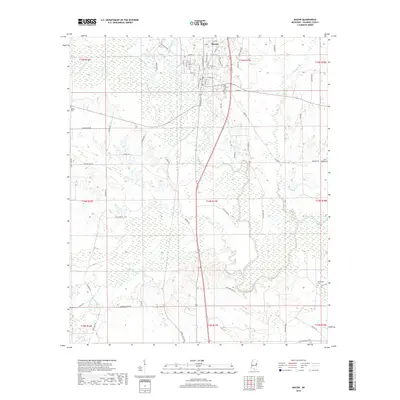
2018 Map of Macon
USGS Topo · Published 2018About this map
The town of Macon serves as a focal point in this East Mississippi landscape, where a grid of streets like W Pearl St and N Jefferson St gives way to the winding course of the Noxubee River. This river, along with tributaries like Horse Hunters Cr and Macedonia Cr, defines the low-lying terrain and floodplains that dominate the surrounding area. Family and community heritage are anchored by several local burial grounds, including Odd Fellows Cem near the town center and the more outlying Salem Cem and DeJarnate Cem. The rural road network, featuring routes such as Polk-Farrar Rd and Running Water Rd, connects these scattered landmarks across the Noxubee County countryside. The abundance of water features, from Howard Lake to the small branches of Dry Cr, reflects a landscape deeply shaped by its natural drainage patterns.
Find a feature on this map
71 named features on this map. Tap any name to fly to it.
Don’t see what you’re looking for? This feature index may not catch every label — zoom into the map to look around manually.
Map Details
Editions of this 2018 Macon Map
This is the sole edition of this map. No revisions or reprints were ever made.
Other maps of this area

1953 · Meridian
USGS Topo · 1:250,000

1953 · West Point
USGS Topo · 1:250,000

1957 · Meridian
USGS Topo · 1:250,000

1958 · West Point
USGS Topo · 1:250,000

1962 · Shuqualak
USGS Topo · 1:24,000

1963 · West Point
USGS Topo · 1:250,000

1963 · Gholson
USGS Topo · 1:24,000

1965 · Meridian
USGS Topo · 1:250,000

1973 · Cliftonville
USGS Topo · 1:24,000

1973 · McLeod
USGS Topo · 1:24,000