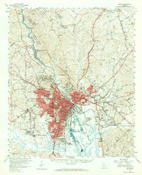
1978 Map of Macon
USGS Topo · Published 1980This historical map portrays the area of Macon in 1978, primarily covering Bibb County as well as portions of Laurens County, Baldwin County, Bleckley County, Macon, Crawford County, Houston County, Jones County, Monroe County, Peach County, Wilkinson County, Twiggs County, and Washington County. Featuring a scale of 1:100000, this map provides a highly detailed snapshot of the terrain, roads, buildings, counties, and historical landmarks in the Macon region at the time. Published in 1980, it is one of 2 known editions of this map due to revisions or reprints.
Find a feature on this map
149 named features on this map. Tap any name to fly to it.
Don’t see what you’re looking for? This feature index may not catch every label — zoom into the map to look around manually.
Map Details
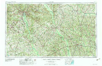
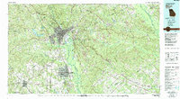
Editions of this 1978 Macon Map
2 editions found
Historical Maps of Oak Grove Through Time
6 maps found