
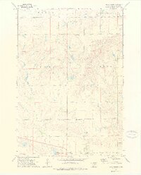
1973 Map of Macs Corner
USGS Topo · Published 1976About this map
Macs Corner serves as a focal point in this 1973 survey of Hyde County, where the plains are divided into the townships of Eagle, Van Order, Dewey, and Peno. The landscape is defined by the Crow Creek Indian Reservation Boundary which cuts through the southern portion of the quadrangle. Water is a vital but sparse resource here, represented primarily by Lake Ambrose and the meandering path of West Fork Elm Creek.
Find a feature on this map
16 named features on this map. Tap any name to fly to it.
Don’t see what you’re looking for? This feature index may not catch every label — zoom into the map to look around manually.
Map Details
Editions of this 1973 Macs Corner Map
2 editions found
Other maps of this area

1953 · Huron
USGS Topo · 1:250,000

1954 · Huron
USGS Topo · 1:250,000

1966 · Big Bend Dam NE
USGS Topo · 1:24,000

1966 · Stephan
USGS Topo · 1:24,000

1966 · Lower Brule NE
USGS Topo · 1:24,000

1973 · Chapelle Lake SE
USGS Topo · 1:24,000

1973 · Macs Corner NE
USGS Topo · 1:24,000

1973 · Macs Corner SE
USGS Topo · 1:24,000

1973 · Chapelle Lake
USGS Topo · 1:24,000
1973 · Macs Corner NW
USGS Topo · 1:24,000
Featured Places
- Fort Thompson District, SD
- Mac's Corner, Fort Thompson District
- Hyde County, SD
- United States
- South Dakota