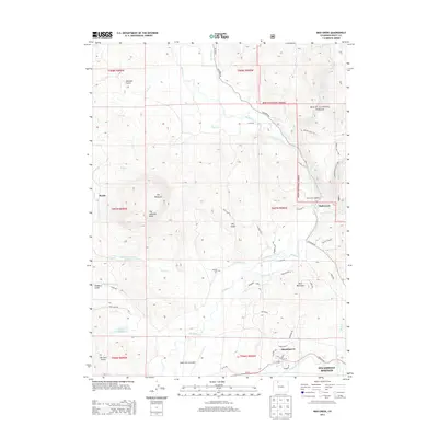
2013 Map of Mad Creek
USGS Topo · Published 2013About this map
Elk Mountain and the distinctive formation of The Sleeping Giant command the western horizon in this region north of the Yampa River. The landscape is a complex network of ranching and water management, evidenced by the Elk Valley Ditch and Keller Ditch feeding into the Elk River corridor. While Steamboat Springs anchors the southeastern corner, the map reveals smaller developments like Steamboat II and the historical site of Mystic. For genealogists, the Elk Mtn Cem provides a specific point of interest near the river. The northeastern section transitions into the Routt National Forest, where the Mad Creek Trailhead serves as a gateway to the wilderness. Notable water features including Trull Cr Reservoir Number 1 and Lake Windemere dot the terrain, illustrating the critical role of water storage in this high-altitude environment.
Find a feature on this map
60 named features on this map. Tap any name to fly to it.
Don’t see what you’re looking for? This feature index may not catch every label — zoom into the map to look around manually.
Map Details
Editions of this 2013 Mad Creek Map
This is the sole edition of this map. No revisions or reprints were ever made.
Other maps of this area

1911 · Hahns Peak
USGS Topo · 1:125,000

1913 · Hahns Peak
USGS Topo · 1:125,000

1923 · Pilot Knob
USGS Topo · 1:62,500

1924 · Mt. Harris
USGS Topo · 1:48,000

1925 · Pilot Knob
USGS Topo · 1:62,500

1926 · Mount Harris
USGS Topo · 1:62,500

1954 · Craig
USGS Topo · 1:250,000

1957 · Craig
USGS Topo · 1:250,000

1958 · Craig
USGS Topo · 1:250,000

1960 · Craig
USGS Topo · 1:250,000