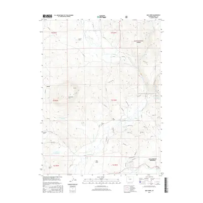
2016 Map of Mad Creek
USGS Topo · Published 2016About this map
Elk Mountain Cem and the small settlement of Mystic sit at the center of this mountain landscape north of Steamboat Springs. The geography is defined by the winding course of the Elk River, which is flanked by an intricate system of water management features like Elk Valley Ditch, Wither Ditch, and Keller Ditch. These irrigation lines, along with Trull Cr Reservoir Number 1, indicate the valley's reliance on managed water for agriculture and ranching amidst the high terrain.
Find a feature on this map
72 named features on this map. Tap any name to fly to it.
Don’t see what you’re looking for? This feature index may not catch every label — zoom into the map to look around manually.
Map Details
Editions of this 2016 Mad Creek Map
This is the sole edition of this map. No revisions or reprints were ever made.
Other maps of this area

1911 · Hahns Peak
USGS Topo · 1:125,000

1913 · Hahns Peak
USGS Topo · 1:125,000

1923 · Pilot Knob
USGS Topo · 1:62,500

1924 · Mt. Harris
USGS Topo · 1:48,000

1925 · Pilot Knob
USGS Topo · 1:62,500

1926 · Mount Harris
USGS Topo · 1:62,500

1954 · Craig
USGS Topo · 1:250,000

1957 · Craig
USGS Topo · 1:250,000

1958 · Craig
USGS Topo · 1:250,000

1960 · Craig
USGS Topo · 1:250,000