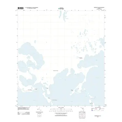
2012 Map of Madeira Bay
USGS Topo · Published 2012About this map
The coastal wetlands and estuarine environment of the Florida Everglades are mapped in detail here, where land and water merge through a network of hammocks and bays. This coastal edge features Maderia Hammock and Little Madeira Hammock, which rise slightly above the surrounding marsh. The hydrological system is defined by large inland water bodies such as Monroe Lake, Middle Lake, and Seven Palm Lake, all connected through drainage points like McCormick Cr. Along the shoreline of Florida Bay, the map traces the intricate geography of Terrapin Point and Crocodile Point. This 2012 survey illustrates the wilderness character of the region, including the Crocodile Point Trl and the remote Black Betsy Keys, showing the shoreline before further sea-level changes affected the Mangrove coast.
Find a feature on this map
18 named features on this map. Tap any name to fly to it.
Don’t see what you’re looking for? This feature index may not catch every label — zoom into the map to look around manually.
Map Details
Editions of this 2012 Madeira Bay Map
This is the sole edition of this map. No revisions or reprints were ever made.
Other maps of this area

1956 · Royal Palm Ranger Station SE
USGS Topo · 1:24,000

1956 · Miami
USGS Topo · 1:250,000

1958 · Miami
USGS Topo · 1:250,000

1967 · Royal Palm Ranger Station SE
USGS Topo · 1:24,000

1971 · Tavernier
USGS Topo · 1:24,000

1972 · Mahogany Hammock
USGS Topo · 1:24,000

1972 · Taylor Slough
USGS Topo · 1:24,000

1972 · Madeira Bay
USGS Topo · 1:24,000

1972 · Pelican Keys
USGS Topo · 1:24,000

1972 · West Lake
USGS Topo · 1:24,000