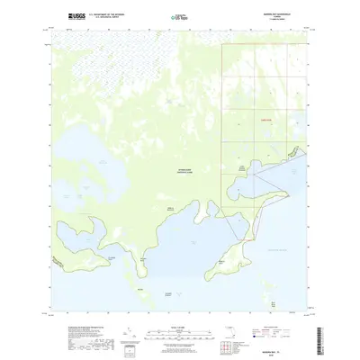
2018 Map of Madeira Bay
USGS Topo · Published 2018About this map
Everglades National Park encompasses this subtropical landscape, where the freshwater discharge of Taylor Slough meets the marine environment of Florida Bay. This specific interface between the mainland and the Atlantic Ocean is defined by a intricate system of bays, creeks, and hammocks. Notable topographical features like Maderia Hammock and Little Madeira Hammock provide slight elevation amidst the surrounding wetlands and mangroves. The intricate coastline is punctuated by Crocodile Point and Terrapin Point, guarding the entrance to Terrapin Bay. Local geography includes several significant inland water bodies such as Seven Palm Lake, Middle Lake, and Monroe Lake, illustrating the complex hydrology that characterizes this part of the southern Florida peninsula. The boundary between Miami-Dade and Monroe counties cuts through this wild terrain, emphasizing the remote nature of the region.
Find a feature on this map
23 named features on this map. Tap any name to fly to it.
Don’t see what you’re looking for? This feature index may not catch every label — zoom into the map to look around manually.
Map Details
Editions of this 2018 Madeira Bay Map
This is the sole edition of this map. No revisions or reprints were ever made.
Other maps of this area

1956 · Royal Palm Ranger Station SE
USGS Topo · 1:24,000

1956 · Miami
USGS Topo · 1:250,000

1958 · Miami
USGS Topo · 1:250,000

1967 · Royal Palm Ranger Station SE
USGS Topo · 1:24,000

1971 · Tavernier
USGS Topo · 1:24,000

1972 · Mahogany Hammock
USGS Topo · 1:24,000

1972 · Taylor Slough
USGS Topo · 1:24,000

1972 · Madeira Bay
USGS Topo · 1:24,000

1972 · Pelican Keys
USGS Topo · 1:24,000

1972 · West Lake
USGS Topo · 1:24,000