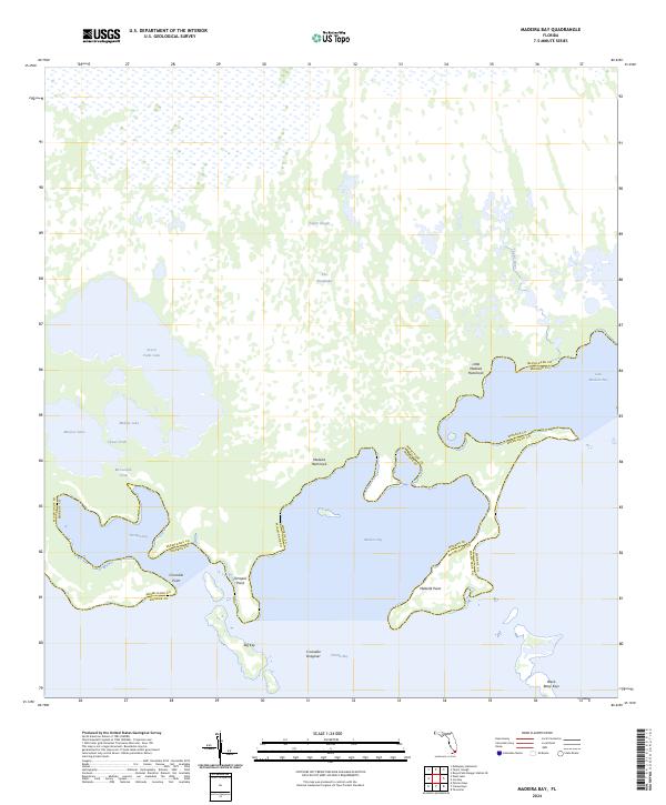
2024 Map of Madeira Bay
USGS Topo · Published 2024About this map
Marjory Stoneman Douglas Wilderness dominates this coastal section of The Everglades, where freshwater outflow meets the salt of Florida Bay. The landscape is defined by the slow movement of water through Taylor Slough and the Taylor River, feeding a complex network of coastal lagoons including Seven Palm Lake, Monroe Lake, and Middle Lake. This modern survey illustrates the intricate interface of the southern Florida shoreline, marking the boundary between Miami-Dade and Monroe counties as it threads through mangrove-lined waters. Significant landforms like Little Madeira Hammock and Madeira Hammock rise slightly above the surrounding wetlands, while named coastal features such as Crocodile Point, Terrapin Point, and Madeira Point help define the northern reach of the bay. The map also records specialized ecological markers like Crocodile Dragover and the isolated Black Betsy Keys, providing a detailed look at this protected wilderness environment.
Find a feature on this map
23 named features on this map. Tap any name to fly to it.
Don’t see what you’re looking for? This feature index may not catch every label — zoom into the map to look around manually.
Map Details
Editions of this 2024 Madeira Bay Map
This is the sole edition of this map. No revisions or reprints were ever made.
Other maps of this area

1956 · Royal Palm Ranger Station SE
USGS Topo · 1:24,000

1956 · Miami
USGS Topo · 1:250,000

1958 · Miami
USGS Topo · 1:250,000

1967 · Royal Palm Ranger Station SE
USGS Topo · 1:24,000

1971 · Tavernier
USGS Topo · 1:24,000

1972 · Mahogany Hammock
USGS Topo · 1:24,000

1972 · Taylor Slough
USGS Topo · 1:24,000

1972 · Madeira Bay
USGS Topo · 1:24,000

1972 · Pelican Keys
USGS Topo · 1:24,000

1972 · West Lake
USGS Topo · 1:24,000