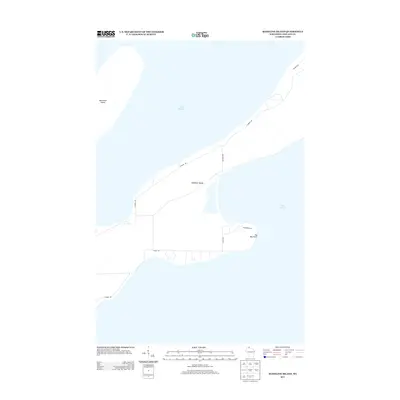
2013 Map of Madeline Island
USGS Topo · Published 2013About this map
Madeline Island and its relationship with the cold waters of Lake Superior are the central focus of this coastal study. The map illustrates the island's interior road network and points of interest, showing the reach of N Shore Dr and S Shore Dr as they navigate the perimeter. To the east, the prominent protrusion of Big Bay Point marks a significant landmark on the island’s shoreline, while across the channel to the northwest, the southern tip of Basswood Island is visible. The layout of local connectors like Benjamin Rd and Haines Rd indicates a landscape shaped by seasonal access and the geography of the Apostle Islands. This record preserves the infrastructure of the island as it existed in the early twenty-first century, providing a baseline for shoreline and development changes.
Find a feature on this map
11 named features on this map. Tap any name to fly to it.
Don’t see what you’re looking for? This feature index may not catch every label — zoom into the map to look around manually.
Map Details
Editions of this 2013 Madeline Island Map
This is the sole edition of this map. No revisions or reprints were ever made.
Other maps of this area

1941 · Bayfield
USGS Topo · 1:48,000

1942 · Ashland
USGS Topo · 1:48,000

1943 · Odanah
USGS Topo · 1:48,000

1945 · Odanah
USGS Topo · 1:48,000

1946 · Bayfield
USGS Topo · 1:48,000

1947 · Ashland
USGS Topo · 1:48,000

1953 · Ashland
USGS Topo · 1:250,000

1958 · Ashland
USGS Topo · 1:250,000

1963 · Oak Island
USGS Topo · 1:24,000
1963 · Stockton Island
USGS Topo · 1:24,000