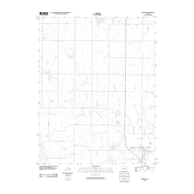
2010 Map of Madison
USGS Topo · Published 2010About this map
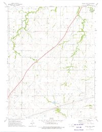
The town of Madison sits at the confluence of several vital waterways in the southeastern corner of this Kansas survey. The landscape is defined by the complex hydrology of the Verdigris River and its multiple tributaries, including the North Branch Verdigris River and the South Branch Verdigris River. This network of creeks—such as Moon Branch, Kelly Branch, and Tate Branch Creek—carves through the prairie, influencing the layout of the rural road system that follows the section lines between Greenwood and Lyon counties. For genealogists and local historians, several burial grounds are preserved across the area, including Zion Cemetery in the northwest, Line Cemetery along Rock Creek, and Blakely Cemetery located near the river bottomlands. The presence of Olpe City Lake in the north and the alignment of Old Hwy 99 entering Madison provide clear markers of the region's development and infrastructure at the start of the 2010s.
Find a feature on this map
37 named features on this map. Tap any name to fly to it.
Don’t see what you’re looking for? This feature index may not catch every label — zoom into the map to look around manually.
Map Details
Editions of this 2010 Madison Map
This is the sole edition of this map. No revisions or reprints were ever made.
Other maps of this area

1888 · Emporia
USGS Topo · 1:125,000

1894 · Emporia
USGS Topo · 1:125,000

1955 · Hutchinson
USGS Topo · 1:250,000

1959 · Hutchinson
USGS Topo · 1:250,000

1967 · Madison SW
USGS Topo · 1:24,000
1967 · Thrall
USGS Topo · 1:24,000
1967 · Lamont
USGS Topo · 1:24,000
1973 · Olpe
USGS Topo · 1:24,000

1973 · Shaw Creek
USGS Topo · 1:24,000
1973 · Phenis Creek
USGS Topo · 1:24,000