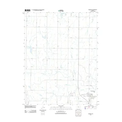
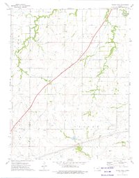
2012 Map of Madison
USGS Topo · Published 2012About this map
Madison serves as the primary hub in this portion of Greenwood County, situated at the confluence of several watercourses including the Verdigris River and the S Br Verdigris River. The surrounding landscape is defined by an orderly grid of township highways and section roads, reflecting the enduring agricultural footprint of the region. Local heritage is preserved in the location of rural burial grounds such as Zion Cem, Blakely Cem, and Line Cem, which dot the uplands between the creek valleys. To the north, Olpe City Lake provides a significant water resource, while a network of smaller tributaries like Moon Br, Kelly Br, and S Eagle Cr carve out the local drainage patterns. The presence of the Madison Wastewater Treatment Facility and the central Po indicates the municipal infrastructure supporting this rural Kansas community.
Find a feature on this map
57 named features on this map. Tap any name to fly to it.
Don’t see what you’re looking for? This feature index may not catch every label — zoom into the map to look around manually.
Map Details
Editions of this 2012 Madison Map
This is the sole edition of this map. No revisions or reprints were ever made.
Other maps of this area

1888 · Emporia
USGS Topo · 1:125,000

1894 · Emporia
USGS Topo · 1:125,000

1955 · Hutchinson
USGS Topo · 1:250,000

1959 · Hutchinson
USGS Topo · 1:250,000

1967 · Madison SW
USGS Topo · 1:24,000
1967 · Thrall
USGS Topo · 1:24,000
1967 · Lamont
USGS Topo · 1:24,000
1973 · Olpe
USGS Topo · 1:24,000

1973 · Shaw Creek
USGS Topo · 1:24,000
1973 · Phenis Creek
USGS Topo · 1:24,000