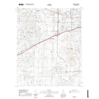
2018 Map of Madison
USGS Topo · Published 2018About this map
Huntsville and Madison anchor this 2018 topographic survey, revealing the dense intersection of modern urban development and significant military installations. The landscape is dominated by the sprawling grounds of the Redstone Arsenal, which includes the Redstone Army Airfield and numerous named summits like Weeden Mtn and Madkin Mtn. The proximity of the Univ-of-Alabama-in-Huntsville and Calhoun Community College highlights the region's role as a center for education and aerospace technology.
Find a feature on this map
64 named features on this map. Tap any name to fly to it.
Don’t see what you’re looking for? This feature index may not catch every label — zoom into the map to look around manually.
Map Details
Editions of this 2018 Madison Map
This is the sole edition of this map. No revisions or reprints were ever made.
Other maps of this area

1888 · Huntsville
USGS Topo · 1:125,000

1892 · Huntsville
USGS Topo · 1:125,000

1936 · Jeff
USGS Topo · 1:24,000

1936 · Capshaw
USGS Topo · 1:24,000

1936 · Triana
USGS Topo · 1:24,000

1936 · Madison
USGS Topo · 1:24,000

1936 · Meridianville
USGS Topo · 1:24,000

1936 · Mason Ridge
USGS Topo · 1:24,000

1936 · Greenbrier
USGS Topo · 1:24,000

1936 · Farley
USGS Topo · 1:24,000