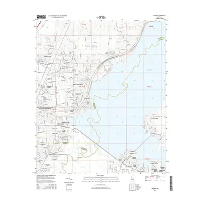
2015 Map of Madison
USGS Topo · Published 2015About this map
The Ross R Barnett Reservoir dominates the eastern landscape of this Mississippi region, where the Pearl River marks the boundary between Madison, Rankin, and Hinds counties. The Natchez Trace Parkway curves through the center, anchoring a network of residential developments and historic sites. Local genealogy is well-represented by several burial grounds, including the Old Christian Union Cem and the Melton Bennett Cem. This era of growth is visible in the transition from open lands to named communities such as Natchez Trace Village and Stonegate. Civil aviation centers on Bruce Campbell Field near Madison, while the Mount Charity Missionary Baptist Church serves as a prominent local landmark. The terrain is defined by a series of creeks, including Haley Cr and Culley Cr, which feed into the primary reservoir and river system.
Find a feature on this map
67 named features on this map. Tap any name to fly to it.
Don’t see what you’re looking for? This feature index may not catch every label — zoom into the map to look around manually.
Map Details
Editions of this 2015 Madison Map
This is the sole edition of this map. No revisions or reprints were ever made.
Other maps of this area

1903 · Jackson
USGS Topo · 1:125,000

1905 · Jackson
USGS Topo · 1:48,000

1908 · Jackson
USGS Topo · 1:62,500

1922 · Pelahatchee
USGS Topo · 1:48,000

1924 · Pelahatchee
USGS Topo · 1:62,500

1950 · Pelahatchie
USGS Topo · 1:62,500

1952 · Pelahatchie
USGS Topo · 1:62,500

1953 · Meridian
USGS Topo · 1:250,000

1955 · Jackson
USGS Topo · 1:250,000

1957 · Meridian
USGS Topo · 1:250,000