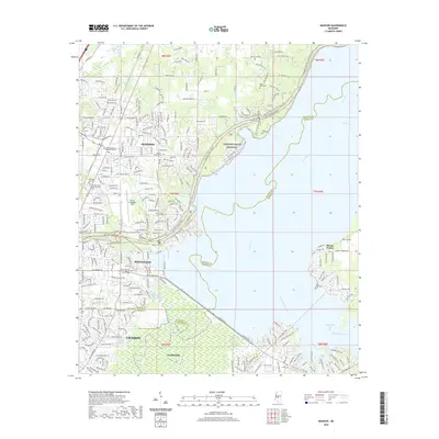
2020 Map of Madison
USGS Topo · Published 2020About this map
Madison and Ridgeland anchor this landscape during a period of modern expansion along the Natchez Trace Pkwy. The mapping detail focuses on the suburban and residential growth north of Jackson, where established neighborhoods meet the expansive waters of the Pearl River and Pelahatchie Bay. Significant local heritage is preserved in numerous family and congregational burial grounds, including the True Vine Baptist Cem and Mount Charity Missionary Baptist Church Cem.
Find a feature on this map
245 named features on this map. Tap any name to fly to it.
Don’t see what you’re looking for? This feature index may not catch every label — zoom into the map to look around manually.
Map Details
Editions of this 2020 Madison Map
This is the sole edition of this map. No revisions or reprints were ever made.
Other maps of this area

1903 · Jackson
USGS Topo · 1:125,000

1905 · Jackson
USGS Topo · 1:48,000

1908 · Jackson
USGS Topo · 1:62,500

1922 · Pelahatchee
USGS Topo · 1:48,000

1924 · Pelahatchee
USGS Topo · 1:62,500

1950 · Pelahatchie
USGS Topo · 1:62,500

1952 · Pelahatchie
USGS Topo · 1:62,500

1953 · Meridian
USGS Topo · 1:250,000

1955 · Jackson
USGS Topo · 1:250,000

1957 · Meridian
USGS Topo · 1:250,000