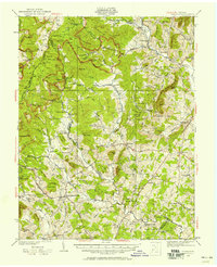
1930 Map of Madison
USGS Topo · Published 1958About this map
The Blue Ridge mountains and Piedmont foothills define this transition from the high ridges of Skyline Drive down to the river valleys of Madison and Greene Counties. Surveyed in the late 1920s, the landscape features The Presidents Camp on the Mill Prong, a unique artifact of the era's presidential retreats. The rural economy is anchored by small crossroads like Graves Mill, Repton Mills, and Eppards Mill, while social life is centered around community landmarks such as Mt Pisgah Ch and the Upper Pocosin Mission. The map traces the winding courses of the Rapidan River and Robinson River, which dictated the early settlement patterns and road networks connecting the county seat at Madison to outlying hamlets like Syria and Stanardsville.
Find a feature on this map
137 named features on this map. Tap any name to fly to it.
Don’t see what you’re looking for? This feature index may not catch every label — zoom into the map to look around manually.
Map Details
Editions of this 1930 Madison Map
3 editions found
Other maps of this area

1892 · Woodstock
USGS Topo · 1:125,000

1892 · Gordonsville
USGS Topo · 1:125,000

1892 · Harrisonburg
USGS Topo · 1:125,000

1893 · Luray
USGS Topo · 1:125,000

1905 · Luray
USGS Topo · 1:125,000

1929 · Stony Man
USGS Topo · 1:48,000

1930 · Madison
USGS Topo · 1:48,000

1931 · University
USGS Topo · 1:62,500

1933 · Stony Man
USGS Topo · 1:62,500

1933 · Madison
USGS Topo · 1:62,500