
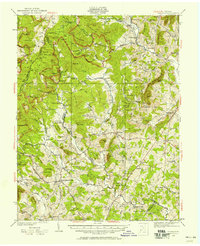
1930 Map of Madison
USGS Topo · Published 1930About this map
President Hoovers Camp and the adjacent U S Marine Camp sit high in the Blue Ridge mountains during this 1930 survey, reflecting the era when the Rapidan River headwaters served as a presidential retreat. The landscape is a network of ridges and hollows defined by the Rapidan River, Robinson River, and Conway River, with the Appalachian Trail winding along the western crest. The transition from the high peaks like Stony Man and Hazel Top down into the piedmont reveals a dense settlement pattern of small communities and rural institutions. The map documents numerous landmarks of social history, including the Upper Pocosin Mission, Lower Pocosin Mission, and various country churches such as Mt Zion Ch and Oak Grove Ch. Prominent local hubs like Madison and Stanardsville anchor the lowlands, connected by the burgeoning State Highway system through the foothills.
Find a feature on this map
125 named features on this map. Tap any name to fly to it.
Don’t see what you’re looking for? This feature index may not catch every label — zoom into the map to look around manually.
Map Details
Editions of this 1930 Madison Map
3 editions found
Other maps of this area

1892 · Woodstock
USGS Topo · 1:125,000

1892 · Gordonsville
USGS Topo · 1:125,000

1892 · Harrisonburg
USGS Topo · 1:125,000

1893 · Luray
USGS Topo · 1:125,000

1905 · Luray
USGS Topo · 1:125,000

1929 · Stony Man
USGS Topo · 1:48,000

1931 · University
USGS Topo · 1:62,500

1933 · Stony Man
USGS Topo · 1:62,500

1933 · Madison
USGS Topo · 1:62,500

1935 · Charlottesville
USGS Topo · 1:62,500