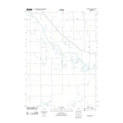
2011 Map of Madison NE
USGS Topo · Published 2011About this map
The Elkhorn River meanders across this rural Stanton County landscape, forming a complex network of oxbows and cutoffs such as Johnson Lake, Loes Lake, and Pillar Lake. This 2011 survey records the agricultural character of the region, where the river's path dictates the placement of rural roads like River Rd and helps define the boundaries of local operations such as Wolff Farms. To the south, the waters of Union Creek and Sand Creek flow toward the Greyson Reservoir, held by the Greyson Dam.
Find a feature on this map
41 named features on this map. Tap any name to fly to it.
Don’t see what you’re looking for? This feature index may not catch every label — zoom into the map to look around manually.
Map Details
Editions of this 2011 Madison NE Map
This is the sole edition of this map. No revisions or reprints were ever made.
Other maps of this area

1955 · Sioux City
USGS Topo · 1:250,000

1955 · Fremont
USGS Topo · 1:250,000

1957 · Fremont
USGS Topo · 1:250,000

1958 · Sioux City
USGS Topo · 1:250,000

1958 · Fremont
USGS Topo · 1:250,000

1959 · Sioux City
USGS Topo · 1:250,000

1963 · Madison
USGS Topo · 1:24,000

1963 · Hoskins
USGS Topo · 1:24,000

1963 · Madison SE
USGS Topo · 1:24,000

1963 · Wayne SW
USGS Topo · 1:24,000