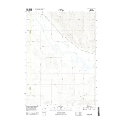
2014 Map of Madison NE
USGS Topo · Published 2014About this map
The Elkhorn River meanders across this Stanton County landscape, carving a wide valley filled with oxbow remnants like Johnson Lake, Loes Lake, and Pillar Lake. This 2014 survey documents a predominantly agricultural region where the section line road grid, including 558 Ave and 834 Rd, defines the movement of people and commerce. The transition from older transit routes is visible where Old Highway 8 meets modern thoroughfares like Ne-24. Genealogists will find several rural burial sites maintained among the fields, specifically Pleasant Run Cem near the banks of Pleasant Run, along with Beltz Cem and Zilmer Cem further east. The southern portion of the map is defined by the drainage of Union Cr and Sand Cr, which feed toward the Greyson Reservoir near the boundary between Madison and Stanton counties.
Find a feature on this map
37 named features on this map. Tap any name to fly to it.
Don’t see what you’re looking for? This feature index may not catch every label — zoom into the map to look around manually.
Map Details
Editions of this 2014 Madison NE Map
This is the sole edition of this map. No revisions or reprints were ever made.
Other maps of this area

1955 · Sioux City
USGS Topo · 1:250,000

1955 · Fremont
USGS Topo · 1:250,000

1957 · Fremont
USGS Topo · 1:250,000

1958 · Sioux City
USGS Topo · 1:250,000

1958 · Fremont
USGS Topo · 1:250,000

1959 · Sioux City
USGS Topo · 1:250,000

1963 · Madison
USGS Topo · 1:24,000

1963 · Hoskins
USGS Topo · 1:24,000

1963 · Madison SE
USGS Topo · 1:24,000

1963 · Wayne SW
USGS Topo · 1:24,000