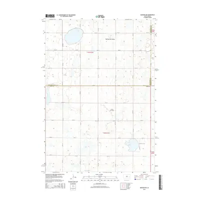
2015 Map of Madison NW
USGS Topo · Published 2015About this map
Coteau des Prairies defines the rolling, potholed geography of this portion of South Dakota, where the landscape is marked by numerous glacial depressions and wetlands. The agrarian character of the region is centered around Spring Lake Colony and the nearby Spring Lake. This 2015 survey illustrates a grid of section roads, such as 217th St and 451st Ave, which separate sprawling fields and small water bodies like Dry Lake and Dooley Slough. To the southeast, the historic Saint Anns Cem overlooks Lake Badus, while Battle Cr drains the undulating terrain. The map captures the boundary intersection of Kingsbury, Brookings, and Lake Counties, reflecting the stable, rural settlement patterns that have characterized this high prairie region for generations.
Find a feature on this map
30 named features on this map. Tap any name to fly to it.
Don’t see what you’re looking for? This feature index may not catch every label — zoom into the map to look around manually.
Map Details
Editions of this 2015 Madison NW Map
This is the sole edition of this map. No revisions or reprints were ever made.
Other maps of this area

1953 · Watertown
USGS Topo · 1:250,000

1958 · Watertown
USGS Topo · 1:250,000

1968 · Lake Sinai
USGS Topo · 1:24,000

1968 · Lake Preston East
USGS Topo · 1:24,000

1968 · Arlington
USGS Topo · 1:24,000

1968 · Ramona
USGS Topo · 1:24,000

1968 · Madison
USGS Topo · 1:24,000

1968 · Sinai
USGS Topo · 1:24,000

1968 · Oldham
USGS Topo · 1:24,000

1968 · Oldham SE
USGS Topo · 1:24,000
Featured Places
- Wayne Township, SD
- Lake Sinai Township, SD
- Spring Lake Hutterite Colony, SD
- Nunda Township, SD
- Badus Township, SD