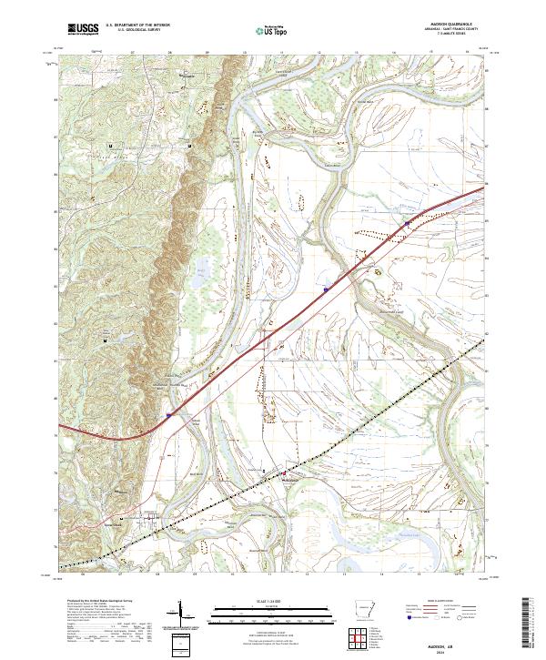
2024 Map of Madison
USGS Topo · Published 2024About this map
Crowleys Ridge rises above the alluvial plains of eastern Arkansas, providing a distinct topographical contrast to the low-lying river bottoms in this St. Francis County landscape. The Saint Francis River meanders through the center of the sheet, defined by numerous loops and cutoffs including Collins Bend, Merriman Bend, and the Clark Corner Cutoff. The settlement of Madison sits at a strategic point where the terrain shifts toward the ridge, while Widener serves the agricultural lands to the east.
Find a feature on this map
81 named features on this map. Tap any name to fly to it.
Don’t see what you’re looking for? This feature index may not catch every label — zoom into the map to look around manually.
Map Details
Editions of this 2024 Madison Map
This is the sole edition of this map. No revisions or reprints were ever made.
Other maps of this area

1939 · Park Place
USGS Topo · 1:62,500

1939 · Wynne
USGS Topo · 1:62,500

1940 · Whitmore
USGS Topo · 1:62,500

1940 · Marianna
USGS Topo · 1:62,500

1948 · Helena
USGS Topo · 1:250,000

1950 · Helena
USGS Topo · 1:250,000

1953 · Memphis
USGS Topo · 1:250,000

1955 · Park Place
USGS Topo · 1:62,500

1955 · Helena
USGS Topo · 1:250,000

1956 · Memphis
USGS Topo · 1:250,000