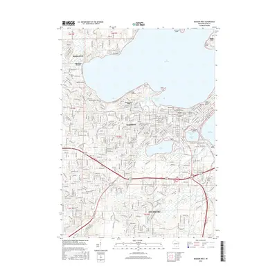
2016 Map of Madison West
USGS Topo · Published 2016About this map
Lake Mendota and Lake Wingra anchor this detailed study of the Madison area, illustrating a densely developed academic and residential landscape. The map highlights the sprawling campus of the Univ of Wisconsin Madison, including Bascom Hill and the Univ of Wisconsin System Administration, alongside Edgewood Coll. This era of the city is marked by its integration of natural shorelines and urban growth, where public spaces like Vilas Beach and James Madison Beach meet established neighborhoods. Significant local history is preserved in the cluster of major cemeteries, including Resurrection Cem and Calvary Cem. Industrial and transport patterns are visible through the path of the Wisconsin Southern RR, which cuts through the southern half of the city near Fitchburg, connecting the urban core to the surrounding drainage of Nine Springs Cr.
Find a feature on this map
392 named features on this map. Tap any name to fly to it.
Don’t see what you’re looking for? This feature index may not catch every label — zoom into the map to look around manually.
Map Details
Editions of this 2016 Madison West Map
This is the sole edition of this map. No revisions or reprints were ever made.
Other maps of this area

1889 · Evansville
USGS Topo · 1:62,500

1890 · Madison
USGS Topo · 1:62,500

1892 · Madison
USGS Topo · 1:62,500

1894 · Evansville
USGS Topo · 1:62,500

1904 · Madison
USGS Topo · 1:62,500

1906 · Evansville
USGS Topo · 1:62,500

1906 · Madison
USGS Topo · 1:62,500

1907 · Cross Plains
USGS Topo · 1:62,500

1909 · Cross Plains
USGS Topo · 1:62,500

1923 · New Glarus
USGS Topo · 1:62,500