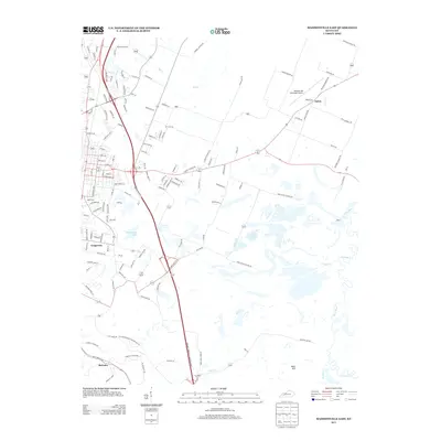
2013 Map of Madisonville East
USGS Topo · Published 2013About this map
Grapevine Lake and the southeastern residential expansion of Madisonville define this landscape at the start of the 2010s. The terrain transitions from the developed street grids of Grapevine and Barnsley into the broad, wetland-rich basins of the Pond River and its many tributaries, including Flat Cr and Elk Cr. This area serves as a critical transportation corridor, where major parkways intersect near localized hubs like the Madisonville Municipal Airport.
Find a feature on this map
130 named features on this map. Tap any name to fly to it.
Don’t see what you’re looking for? This feature index may not catch every label — zoom into the map to look around manually.
Map Details
Editions of this 2013 Madisonville East Map
This is the sole edition of this map. No revisions or reprints were ever made.
Other maps of this area

1907 · Earlington
USGS Topo · 1:48,000

1909 · Dawson Springs
USGS Topo · 1:48,000

1909 · Earlington
USGS Topo · 1:62,500

1909 · Madisonville
USGS Topo · 1:62,500

1911 · Dawson Springs
USGS Topo · 1:62,500

1912 · Nortonville
USGS Topo · 1:62,500

1952 · Sacramento
USGS Topo · 1:24,000

1952 · Hanson
USGS Topo · 1:24,000

1953 · Nortonville
USGS Topo · 1:24,000

1953 · Madisonville East
USGS Topo · 1:24,000