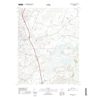
2019 Map of Madisonville East
USGS Topo · Published 2019About this map
Madisonville serves as the primary hub of this landscape, where urban density transitions into the coal-rich creek bottoms of the western Kentucky coalfield. The terrain is defined by the winding course of the Pond River and its various tributaries, including Flat Creek and Drakes Creek. Outside the city center, smaller communities such as Grapevine, Barnsley, and Mortons Gap are situated along the transportation corridors that move south toward the county line. This 2019 survey documents the modern infrastructure of the region, including the Madisonville Regional Airport and the network of rural roads like Pond River-Collieries Road that hint at the area's industrial history. Genealogists will find several notable burial sites recorded, such as Hicklin Cemetery near Anton and the Flat Creek Cemetery, which offer fixed points of reference for local family histories.
Find a feature on this map
108 named features on this map. Tap any name to fly to it.
Don’t see what you’re looking for? This feature index may not catch every label — zoom into the map to look around manually.
Map Details
Editions of this 2019 Madisonville East Map
This is the sole edition of this map. No revisions or reprints were ever made.
Other maps of this area

1907 · Earlington
USGS Topo · 1:48,000

1909 · Dawson Springs
USGS Topo · 1:48,000

1909 · Earlington
USGS Topo · 1:62,500

1909 · Madisonville
USGS Topo · 1:62,500

1911 · Dawson Springs
USGS Topo · 1:62,500

1912 · Nortonville
USGS Topo · 1:62,500

1952 · Sacramento
USGS Topo · 1:24,000

1952 · Hanson
USGS Topo · 1:24,000

1953 · Nortonville
USGS Topo · 1:24,000

1953 · Madisonville East
USGS Topo · 1:24,000