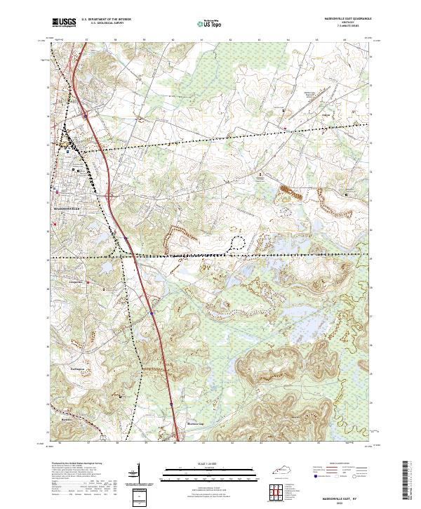
2022 Map of Madisonville East
USGS Topo · Published 2022About this map
The city of Madisonville and its surrounding coal-country landscape anchor this modern survey of eastern Hopkins County. The terrain is defined by the broad lowlands of the Pond River and its tributaries, including Elk Cr and Flat Cr, which wind through a mosaic of wetlands and agricultural tracts. Evidence of the region’s long mining history remains visible in the industrial road names like National Mine Rd and Curtis Mine Rd. This sheet is particularly valuable for genealogists, as it meticulously identifies numerous local burial sites such as Hicklin Cem, Bethlehem Christian Church Cem, and Browder's Church Cem. Smaller communities like Grapevine, Anton, and Mortons Gap are shown in relation to major transport corridors and the Madisonville Regional Airport, providing a clear view of the settlement patterns where the western coalfields meet the river bottomlands.
Find a feature on this map
123 named features on this map. Tap any name to fly to it.
Don’t see what you’re looking for? This feature index may not catch every label — zoom into the map to look around manually.
Map Details
Editions of this 2022 Madisonville East Map
This is the sole edition of this map. No revisions or reprints were ever made.
Other maps of this area

1907 · Earlington
USGS Topo · 1:48,000

1909 · Dawson Springs
USGS Topo · 1:48,000

1909 · Earlington
USGS Topo · 1:62,500

1909 · Madisonville
USGS Topo · 1:62,500

1911 · Dawson Springs
USGS Topo · 1:62,500

1912 · Nortonville
USGS Topo · 1:62,500

1952 · Sacramento
USGS Topo · 1:24,000

1952 · Hanson
USGS Topo · 1:24,000

1953 · Nortonville
USGS Topo · 1:24,000

1953 · Madisonville East
USGS Topo · 1:24,000