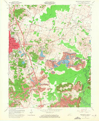
1963 Map of Madisonville East
USGS Topo · Published 1971About this map
Madisonville serves as the industrial and civic anchor of this West Kentucky landscape, where the expansion of the coal industry is etched directly into the topography. The map reveals extensive extractive operations, with prominent Strip Mine symbols and broken contour lines indicating areas of excavation. These industrial zones intersect with the regional transportation network, dominated by the Louisville and Nashville and Illinois Central railroads, which facilitated the movement of coal.
Find a feature on this map
33 named features on this map. Tap any name to fly to it.
Don’t see what you’re looking for? This feature index may not catch every label — zoom into the map to look around manually.
Map Details
Editions of this 1963 Madisonville East Map
This is the sole edition of this map. No revisions or reprints were ever made.
Other maps of this area

1907 · Earlington
USGS Topo · 1:48,000

1909 · Dawson Springs
USGS Topo · 1:48,000

1909 · Earlington
USGS Topo · 1:62,500

1909 · Madisonville
USGS Topo · 1:62,500

1911 · Dawson Springs
USGS Topo · 1:62,500

1912 · Nortonville
USGS Topo · 1:62,500

1952 · Sacramento
USGS Topo · 1:24,000

1952 · Hanson
USGS Topo · 1:24,000

1953 · Nortonville
USGS Topo · 1:24,000

1953 · Madisonville East
USGS Topo · 1:24,000