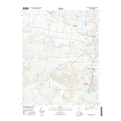
2016 Map of Madisonville West
USGS Topo · Published 2016About this map
The western suburbs of Madisonville and the industrial corridors of Hopkins County define this 2016 survey. The landscape is a network of small residential developments and active infrastructure, where the CSX Transportation rail line runs adjacent to historical mining-era communities like Hecla, Victoria, and Wesco. Water management is prominent across the terrain, with the Loch Mary Reservoir and Lake Peewee serving as significant landmarks alongside the drainage of Greasy Creek and Pond Creek.
Find a feature on this map
132 named features on this map. Tap any name to fly to it.
Don’t see what you’re looking for? This feature index may not catch every label — zoom into the map to look around manually.
Map Details
Editions of this 2016 Madisonville West Map
This is the sole edition of this map. No revisions or reprints were ever made.
Other maps of this area

1907 · Earlington
USGS Topo · 1:48,000

1909 · Dawson Springs
USGS Topo · 1:48,000

1909 · Earlington
USGS Topo · 1:62,500

1909 · Madisonville
USGS Topo · 1:62,500

1911 · Dawson Springs
USGS Topo · 1:62,500

1912 · Nortonville
USGS Topo · 1:62,500

1952 · Hanson
USGS Topo · 1:24,000

1953 · Nortonville
USGS Topo · 1:24,000

1953 · Madisonville East
USGS Topo · 1:24,000

1954 · Evansville
USGS Topo · 1:250,000