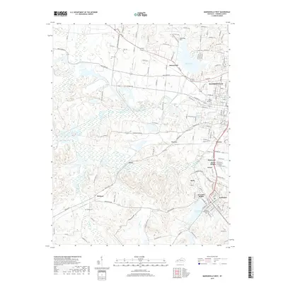
2019 Map of Madisonville West
USGS Topo · Published 2019About this map
Madisonville anchors the eastern edge of this western Kentucky landscape, where the urban street grid gives way to the complex hydrology of the Pennyrile region. The map reveals a transition from the structured residential blocks of Dozier Heights and West Side Heights to the winding creek valleys of Pond Cr and Greasy Cr. This 2019 survey documents a landscape defined by significant water management and varied terrain, with the Shake Rag Hills and Mitchell Hill rising above the floodplains. Large water bodies like Lake Peewee and the Loch Mary Reservoir dominate the local geography, serving as critical infrastructure for the surrounding communities of Earlington, Richland, and Victoria. Genealogists will find a high density of documented burial sites scattered across the countryside, including the centrally located Odd Fellows Cem and more remote family or community plots such as Tapp Cem and Wicks Cem.
Find a feature on this map
147 named features on this map. Tap any name to fly to it.
Don’t see what you’re looking for? This feature index may not catch every label — zoom into the map to look around manually.
Map Details
Editions of this 2019 Madisonville West Map
This is the sole edition of this map. No revisions or reprints were ever made.
Other maps of this area

1907 · Earlington
USGS Topo · 1:48,000

1909 · Dawson Springs
USGS Topo · 1:48,000

1909 · Earlington
USGS Topo · 1:62,500

1909 · Madisonville
USGS Topo · 1:62,500

1911 · Dawson Springs
USGS Topo · 1:62,500

1912 · Nortonville
USGS Topo · 1:62,500

1952 · Hanson
USGS Topo · 1:24,000

1953 · Nortonville
USGS Topo · 1:24,000

1953 · Madisonville East
USGS Topo · 1:24,000

1954 · Evansville
USGS Topo · 1:250,000