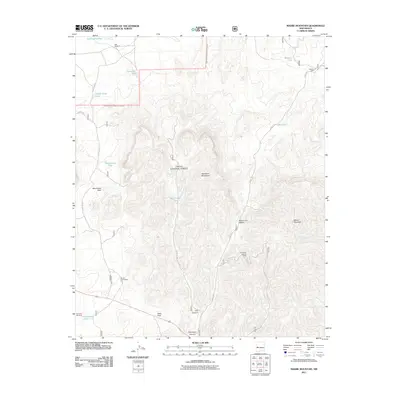
2011 Map of Madre Mountain
USGS Topo · Published 2011About this map
Cibola National Forest encompasses the high desert terrain of this region, dominated by the Sawtooth Mountains and the prominent peak of Madre Mountain. The landscape is characterized by a series of essential water catchments and isolated outposts, reflecting the ranching and forestry operations that define the area. To the north, Webster Cabin sits near Webster Tank, while the Double Circle Ranch is situated in the southern reaches below West Pass. These sites, along with the Davenport Lookout Tower, highlight the managed nature of this wilderness. The distribution of features like the Dike Windmill and Driveway Windmill underscores the critical importance of water management in this arid environment. Significant landmarks such as Monument Rock and Monument Saddle serve as natural navigational aids through the complex topography of Hay Canyon and Davenport Canyon.
Find a feature on this map
27 named features on this map. Tap any name to fly to it.
Don’t see what you’re looking for? This feature index may not catch every label — zoom into the map to look around manually.
Map Details
Editions of this 2011 Madre Mountain Map
This is the sole edition of this map. No revisions or reprints were ever made.
Other maps of this area

1954 · Saint Johns
USGS Topo · 1:250,000

1954 · Socorro
USGS Topo · 1:250,000

1957 · Saint Johns
USGS Topo · 1:250,000

1958 · Socorro
USGS Topo · 1:250,000

1958 · Saint Johns
USGS Topo · 1:250,000

1962 · Socorro
USGS Topo · 1:250,000

1962 · Saint Johns
USGS Topo · 1:250,000

1963 · Cal Ship Mesa
USGS Topo · 1:24,000

1963 · Datil
USGS Topo · 1:24,000

1964 · Third Canyon
USGS Topo · 1:24,000