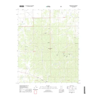
2020 Map of Madre Mountain
USGS Topo · Published 2020About this map
The Sawtooth Mountains and the northern reaches of the Datil Mountains dominate this high-altitude landscape within the Cibola National Forest. This terrain is defined by its complex drainage systems and isolated water sources, essential for ranching and wildlife in this arid region of Catron County. Named canyons like Ox Spring Canyon and Gooseberry Canyon cut through the volcanic ridges, leading toward the prominent peak of Madre Mtn.
Find a feature on this map
43 named features on this map. Tap any name to fly to it.
Don’t see what you’re looking for? This feature index may not catch every label — zoom into the map to look around manually.
Map Details
Editions of this 2020 Madre Mountain Map
This is the sole edition of this map. No revisions or reprints were ever made.
Other maps of this area

1954 · Saint Johns
USGS Topo · 1:250,000

1954 · Socorro
USGS Topo · 1:250,000

1957 · Saint Johns
USGS Topo · 1:250,000

1958 · Socorro
USGS Topo · 1:250,000

1958 · Saint Johns
USGS Topo · 1:250,000

1962 · Socorro
USGS Topo · 1:250,000

1962 · Saint Johns
USGS Topo · 1:250,000

1963 · Cal Ship Mesa
USGS Topo · 1:24,000

1963 · Datil
USGS Topo · 1:24,000

1964 · Third Canyon
USGS Topo · 1:24,000