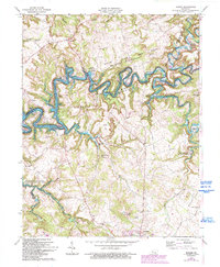
1963 Map of Madrid
USGS Topo · Published 1993About this map
Rough River Lake dominates the central landscape of this 1960s survey, its winding fingers reaching deep into the drainage basins of Peter Creek and Clifty Creek. This man-made reservoir transformed the geography of the Grayson County borderlands, creating a jagged shoreline that isolated former hilltops and established new recreational areas like the Eveleigh Public Use Area. On the higher ground above the inundation, old rural settlements like Madrid and Hardin Springs persist, connected by a network of ridge roads that link family landmarks and congregations.
Find a feature on this map
39 named features on this map. Tap any name to fly to it.
Don’t see what you’re looking for? This feature index may not catch every label — zoom into the map to look around manually.
Map Details
Editions of this 1963 Madrid Map
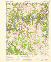
2 editions found
Other maps of this area

1922 · Leitchfield
USGS Topo · 1:48,000

1925 · Cub Run
USGS Topo · 1:62,500

1925 · Leitchfield
USGS Topo · 1:62,500

1932 · Big Clifty
USGS Topo · 1:62,500

1949 · Constantine
USGS Topo · 1:24,000

1949 · Big Clifty
USGS Topo · 1:24,000

1949 · Big Clifty
USGS Topo · 1:62,500

1953 · Custer
USGS Topo · 1:24,000

1953 · Mc Daniels
USGS Topo · 1:24,000

1953 · Kingswood
USGS Topo · 1:24,000