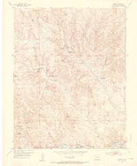
1951 Map of Madrid
USGS Topo · Published 1953About this map
Boncarbo and Primero stand as primary markers of industrial history in Las Animas County during the early 1950s, a period when the local landscape was heavily defined by the coal economy. The map reveals an extensive network of extractive operations, including the Eureka Mine, Viola Mine, and the sprawling Primero Mine North. This concentration of industry is mirrored by the social infrastructure of the day, where now-closed facilities like Middle Burro Canyon School and Midway School indicate shifts in local population centers.
Find a feature on this map
49 named features on this map. Tap any name to fly to it.
Don’t see what you’re looking for? This feature index may not catch every label — zoom into the map to look around manually.
Map Details
Editions of this 1951 Madrid Map
3 editions found
Other maps of this area

1891 · Spanish Peaks
USGS Topo · 1:125,000

1893 · Spanish Peaks
USGS Topo · 1:125,000

1895 · Spanish Peaks
USGS Topo · 1:125,000

1897 · Spanish Peaks
USGS Topo · 1:125,000

1900 · Spanish Peaks
USGS Topo · 1:125,000

1951 · Trinidad
USGS Topo · 1:24,000

1951 · Valdez
USGS Topo · 1:24,000

1951 · Madrid
USGS Topo · 1:24,000
1951 · Starkville
USGS Topo · 1:24,000

1954 · Trinidad
USGS Topo · 1:250,000