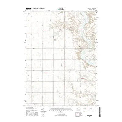
2015 Map of Madrid NW
USGS Topo · Published 2015About this map
The Des Moines River carves a deep valley through this portion of Boone County, creating a landscape of sharp relief defined by prominent high points like Blank Ridge, Buffalo Ridge, and Frankel Ridge. This terrain, a departure from the surrounding plains, is drained by numerous tributaries including Bear Cr, Eversoll Cr, and Thrasher Cr. The map is particularly valuable for genealogical research, as it identifies several small rural burial sites scattered across the township, including the James Gildea Cem and the Peoples Cem. Near the southern edge of the survey, the State Hospital Cem and Liberty Cem mark long-established land uses. Away from the river breaks, the land transitions to a regular grid of section roads like Co Hwy R18 and 280th St, indicating the agricultural foundation of the local economy.
Find a feature on this map
53 named features on this map. Tap any name to fly to it.
Don’t see what you’re looking for? This feature index may not catch every label — zoom into the map to look around manually.
Map Details
Editions of this 2015 Madrid NW Map
This is the sole edition of this map. No revisions or reprints were ever made.
Other maps of this area

1911 · Madrid
USGS Topo · 1:62,500

1914 · Madrid
USGS Topo · 1:62,500

1916 · Boone
USGS Topo · 1:62,500

1950 · Perry
USGS Topo · 1:62,500

1951 · Perry
USGS Topo · 1:62,500

1951 · Ogden
USGS Topo · 1:62,500

1954 · Omaha
USGS Topo · 1:250,000

1954 · Waterloo
USGS Topo · 1:250,000

1954 · Fort Dodge
USGS Topo · 1:250,000

1954 · Des Moines
USGS Topo · 1:250,000