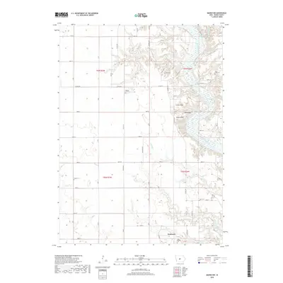
2018 Map of Madrid NW
USGS Topo · Published 2018About this map
Woodward stands at the southern edge of this Iowa landscape, where the plateau gives way to the deep carving of the Des Moines River. This 2018 survey reveals a terrain defined by agricultural grid roads such as Co Hwy R18 and Co Hwy E57, broken only by the sharp relief of the river valley. Numerous family and institutional burial grounds are scattered across the quadrangle, including the State Hospital Cem and James Gildea Cem, providing a significant record for genealogical research. To the north, the river is flanked by distinct elevations like Buffalo Ridge and Frankel Ridge, while smaller waterways like Bear Cr and Preston Cr feed into the primary channel. The presence of Lost Lake near the river bend illustrates the shifting hydrology of this alluvial corridor.
Find a feature on this map
55 named features on this map. Tap any name to fly to it.
Don’t see what you’re looking for? This feature index may not catch every label — zoom into the map to look around manually.
Map Details
Editions of this 2018 Madrid NW Map
This is the sole edition of this map. No revisions or reprints were ever made.
Other maps of this area

1911 · Madrid
USGS Topo · 1:62,500

1914 · Madrid
USGS Topo · 1:62,500

1916 · Boone
USGS Topo · 1:62,500

1950 · Perry
USGS Topo · 1:62,500

1951 · Perry
USGS Topo · 1:62,500

1951 · Ogden
USGS Topo · 1:62,500

1954 · Omaha
USGS Topo · 1:250,000

1954 · Waterloo
USGS Topo · 1:250,000

1954 · Fort Dodge
USGS Topo · 1:250,000

1954 · Des Moines
USGS Topo · 1:250,000