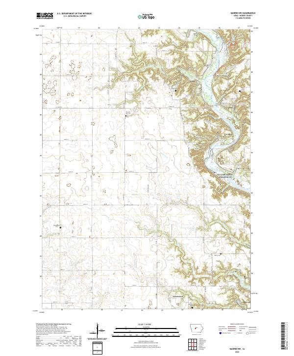
2022 Map of Madrid NW
USGS Topo · Published 2022About this map
Woodward anchor the southwestern corner of this Iowa landscape, where the flat upland agricultural fields give way to the deeply carved valley of the Des Moines River. The eastern edge of the map is defined by the sharp topographical relief of the river bluffs, featuring prominent heights like Frankel Ridge, Blank Ridge, and Buffalo Ridge. These elevations overlook the river bottoms and Lost Lake, creating a distinct contrast with the grid-patterned farmland to the west. For genealogists and local historians, the sheet is particularly valuable for its density of burial sites. Beyond several community cemeteries including Sparks Cem and Peoples Cem, the map identifies the isolated James Gildea Grave near the river bluffs. The land use reveals a mix of recreational trails like the Prairie Trl and institutional history at the State Hospital Cem.
Find a feature on this map
53 named features on this map. Tap any name to fly to it.
Don’t see what you’re looking for? This feature index may not catch every label — zoom into the map to look around manually.
Map Details
Editions of this 2022 Madrid NW Map
This is the sole edition of this map. No revisions or reprints were ever made.
Other maps of this area

1911 · Madrid
USGS Topo · 1:62,500

1914 · Madrid
USGS Topo · 1:62,500

1916 · Boone
USGS Topo · 1:62,500

1950 · Perry
USGS Topo · 1:62,500

1951 · Perry
USGS Topo · 1:62,500

1951 · Ogden
USGS Topo · 1:62,500

1954 · Omaha
USGS Topo · 1:250,000

1954 · Waterloo
USGS Topo · 1:250,000

1954 · Fort Dodge
USGS Topo · 1:250,000

1954 · Des Moines
USGS Topo · 1:250,000